
I started off at the official trailhead at 6:40 and decided I needed to get a move on. I quickly passed two groups and came to a clearing in the woods. Most of the peaks I could see were shrouded in clouds as the sun was poking it's head out.

This is the same peak just a few minutes later after the sun had burnt the clouds off.

I hiked up above treeline through some switchbacks and found a horse on the trail in front of me. I had to stop for a picture op. (If you don't get the horse reference, click here and watch the video.)

I summitted in about 3 hours and there was already a crowd on top from the standard route. After eating a bit of pasta I remembered some advice from a friend of mine. Apparently it was pretty easy to traverse to North Massive, so I decided to go for it (with no further knowledge than "there is the next peak"). The sky's were clear, I had plenty of energy, and I didn't feel like being surrounded by the crowd. North Massive can be seen as the highest peak in the distance. Most of the traverse on the ridge looked easy, but I wasn't sure about the last section leading to the peak.

These look back to the right of the route I took up from the top of Mt. Massive. You can see both of the Halfmoon Lakes in the second shot.


Off I go to conquer the trail to North Massive. Since I wasn't sure of the route, I decided that I would turn around if I lost the trail or got into any really sketchy territory. The first part of the route was easy as long as I kept my eyes open on the trail ahead. The trail dissipated as I approached the peak and got into some bigger rocks. I had to hunt for cairns that marked the way instead. I had my eye on the face of North Massive for the whole hike. It was looking steeper and steeper with no apparent trail. Eventually I came to the section I was dreading. The mountain was steep with lots of loose rock lying around huge sturdy boulders. After studying the route I decided to slowly ascend to just below the ridge and then scramble to the saddle before the peak. I noticed a guy waving at me from the summit which eased my nerves. At least if I fell he would likely hear me and could call Search and Rescue. The section I went up would be easy by my usual climbing standards... when I have a climbing partner, climbing shoes, and a ROPE! I was very careful to make sure each rock I grabbed or put my foot on was sturdy before moving any weight on it. It was pretty slow going, but I'd rather be slow than dead. I finally made it to the saddle. I think it was the first time I exhaled in about 10 minutes. This is the area I had scrambled across. I started the sketchy part from about the boulder on the far right of the picture and made my way across a small gulley and above the spire in the middle of the picture.

Once I got to the top I realized that the trail actually went on the other side of the mountain from the hard section I crossed. Oh well, I arrived safely and more confident of my climbing skills. Two other guys had just reached the summit and were about to make the traverse over to Massive. I advised them to stick to the left and avoid the section I crossed. That trail must have been REALLY easy because they were on the other side in about 2 minutes. I met a guy on the summit and we talked for a few minutes. He asked if I planned to hike to Point 14,001 for the full traverse and I decided I might as well. The clouds were barely gathering and not threatening. He also showed me another route down so I didn't have to traverse all the way back to Massive before descending. Here is the traverse back to Massive that I avoided. You can see Mt. Elbert to the right in the distance.

He took off for Point 14,001 as I finished changing my socks and eating some more pasta. I caught up to him after descending a scree field and we hiked the rest of the way out together. It started thundering and we got some thick, heavy, wet snow. It was time to really move so we could get to treeline.
Kevin (the guy I met) actually knows alot of the other people I have met in the Vail Valley that climb 14ers. We enjoyed a beer at our cars and I headed to town for some food. I started getting a really intense headache as I drove out. This looks back at Mount Massive. The main peak is towards the middle and North Massive is the sharkstooth point on the far right.

Once back in Leadville, I parked in front of Rosie's and my headache was still pounding. I leaned my seat back and ended up passing out for an hour. After a much deserved burger and beer, I made my way towards the trailhead for Missouri Mountain.
I found a spot to park and set up my tent. Only I never set up my tent because I passed out in the back of my car at 6 p.m. and slept through the night. I love sleep! After the great night of much needed sleep, I hit the trail around 5 a.m. on Sunday. It was the same steep switchbacks we hiked when we went up Belford and Oxford. I got a glimpse of the sunrise through the forest every once in a while.

Just before treeline I passed the abandoned cabin. I can't believe someone actually had a HOUSE this far up in the mountains. The mountain men and miners of times past put us to shame.

Just out of the forest I got my first glimpse of Missouri Mountain for the day. A thin strip of the peak and the ridge leading to it was lit up by the rising sun.

Most of this hike was the same as the trail for Belford and Oxford, so I trucked along pretty fast. The only group I saw on my trail was pretty far ahead, but I was determined to catch up with them and beat them to the summit. I finally passed them on the ridge that led to the summit. This was shortly before the only hard part of the hike. There is a section you have to climb down and then leads to a part that is steep with really loose dirt. I carefully passed this part and made my way to the summit. You can see the part you have to climb down in the pic on the left with the shadows. Mount Elbert is off in the distance to the right.

I didn't stay on top very long because I was ready to get a beer at my car. I passed over 25 people on my way down, so I was glad that I started early and hiked fast. The little guys below were all over the trail. They had some really cool shades of green and red. These two were the most barbaric. The one on the bottom was fodder for his feasting friends.

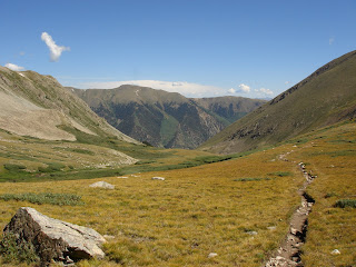
The hike down through the basin was pretty.
I passed several people who were all curious about what the trail ahead held for them. I was glad to take a break and doll out advice on my way down to my celebration beer.

No comments:
Post a Comment